Roesler, Talebpour develop high-precision, all-weather V2I sensing system
Adverse weather conditions such as snow, heavy rain and fog impact the performance of sensors that assist vehicles with tasks like staying in lanes, providing warnings and more.
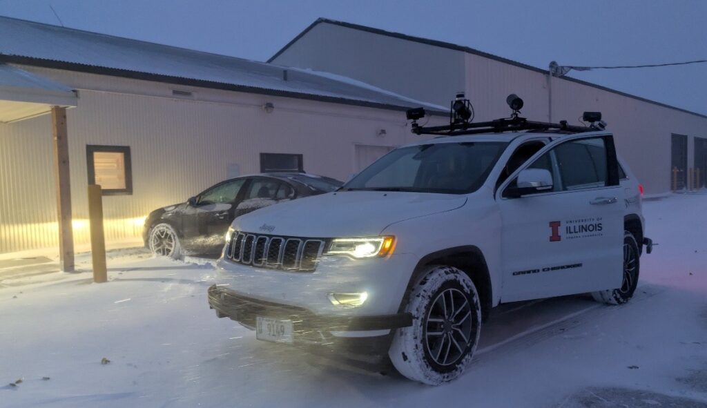
Photo by: Apidej Sakulneya/University of Illinois at Urbana-Champaign
CHAMPAIGN—An Illinois Center for Transportation team, led by faculty leads Jeffery Roesler and Alireza Talebpour, is using pavement surface to improve vehicle sensor performance in all-weather conditions. Also assisting are graduate research assistants Apidej Sakulneya, Chun-Chien Hsiao and Pengyuan Liu.
The project, funded by the Center for Connected and Automated Transportation, aims to develop a passive sensing system that allows vehicles and infrastructure to communicate using electromagnetic markings studied in an earlier CCAT project.
The electromagnetic markings, embedded in or placed on pavement, communicate to vehicles through on-board magnetometer sensors, which then convey audiovisual warnings to drivers.

“Together, they offer a low-cost, infrastructure-assisted maneuvering and guidance layer that improves CAV (connected and automated vehicle) performance in visually challenging or GPS-degraded environments”
Dr. Jeffery Roesler, Ernest J. Barenberg Professor of Civil and Environmental Engineering, University of Illinois at Urbana-Champaign
Their developed system, which does not require external power, will rely on the electromagnetic markings to provide where and how a vehicle should move with high precision. It will plan how a vehicle should maneuver within an inch of accuracy as well as give guidance on speed.
A key focus of their system is to ensure consistent performance under weather conditions where vision-based systems are unreliable or often fail — particularly in snow.

Photo: Apidej Sakulneya/University of Illinois at Urbana-Champaign
To develop their sensing system, Roesler and Talebpour created and tested two algorithms for sensor fusion and motion planning.
The sensor fusion algorithm combines data from the electromagnetic markings, vehicle’s magnetometers and vehicle motion to provide positioning within a lane and to estimate speed. The motion-planning algorithm generates safe trajectories for lane-keeping, merging and controlling speed.
They compared the system’s lateral positioning and speed estimates against visual observations and GPS measurements to confirm its reliability and consistency.
The developed system promises to provide transportation agencies with an affordable and low-maintenance tool for human-driven vehicles as well as connected and automated ones in all-weather conditions.

Photo: Apidej Sakulneya/University of Illinois at Urbana-Champaign
“The system should significantly reduce crash risks from lane departures and unsafe driving in construction work zones by enabling targeted warnings such as speed limits, lane-merge alerts, and controlling vehicles through lane-keeping assist,” Roesler said.
“Overall, the V2I (vehicle-to-infrastructure) technology supports safer and more predictable roadway operations without requiring costly new communications infrastructure,” he added.
This story was written by McCall Macomber of the Illinois Center for Transportation.